pH, salinity and the trees – regional
What do you know about your regional water catchment?
Our unique environmental project ‘pH, salinity and the trees of the Lower Wimmera‘ shared the nine groups’ local research on trees and water quality of their nearest water place during National Science Week 2011, for a regional view in National Water Week. The National Water Week activities were made possible by funding from the Wimmera Catchment Management Authority and continued to support both 2011 International Years : Forests and Chemistry.
What are the key big trees along the Lower Wimmera Streams?
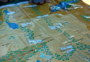
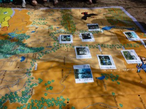
We discovered that there were similar trees along the streams of the Lower Wimmera. A linear forest followed the water courses of our catchment – the Wimmera River and its distributary, the Yarriambiack Creek. This was depicted very clearly in the big Waterwatch map. The River Red Gums were closest to the stream channel and Black Boxes a bit further back – where floods were rare, but sometimes came.
Trees matter in so many ways
We discovered shared values of the trees amongst the children like being places to climb, makers of oxygen, and habitat for creatures.
We also discovered that each group had identified a unique value for their trees : learning place (Beulah P. S.) , wealth (Jeparit P. S.), longevity (St Josep’s P. S.) , flood indicator ( St Mary’s P.S. ) medicines (St Peters Lutheran School) and story ideas (Yaapeet P. S.) .
The adult group added in inspiration and carbon storage, and the Wotjobaluk elder added in a wonderful perspective on history with the traditional uses of the Be-als ( a traditional word for River Red Gums) .
You can find more of this on the Perth Zoo Global Forests website or on our Wimmera pages from it. Or if you want ot see the full range of responses wit their photos, treevalues-from-IYF-photos .
Was the water ok?

August 2011 Salinity and pH readings from the lower Wimmera catchment in situ on the big Wimmera map.
Salinity readings were fairly similar along the River and Creek, most being around the 1000 uS/cm EC’s , so salt would just have been detected, if this water was tasted. This was a big change from the <300 uS/cm EC’s that went through in the flood. Was this considered ok by the children? Well yes, while it was a moderate salinity level , it was water mostly in places that had, a year earlier, been without any water or with water as salty as the sea! The lowest places for salt were in Lake Lascelles and Turkey Bottom Ponds (Yaapeet) which had not received water flowing from the Wimmera River in the flood.
pH readings showed a little more variety. They were neutral in the southern part of the Lower Catchment, but alkaline in the north – most likely a reflection of the grounds there too. So that was felt to be ok too.
IF you are interested in the actual data it is here: water-data-from-ph-salinity-and-trees-project
How healthy are our water places?
The children were surveyed to see how they felt about the health of their local and regional environments. Most felt they were good – and they do look so with water back in them again!
How can we care for our water places?
The children were also surveyed to see what they thought they could do or observed needed doing to care more for our water places. The most common response was about litter, either being responsible for our own and not dropping it, or joining with others to help clean up any mess.
It was great to hear responses like this one from Hope, a senior student at St Mary’s P. S. Warracknabeal, “Work with others to care for all our trees and the creek as you would like to be cared about”!
PS if you would like to read about this project in a media release formm this is it ph-salinity-and-trees-REPORT


